Forward-only search
15x15 grids, 12 targets, and forward horizontal, vertical, and diagonal paths.
Explore twelve original grids covering map skills, terrain, rivers, coasts, glaciers, drylands, plate geography, world regions, geospatial data, settlement, and fieldwork. Choose three difficulty levels and get a matching answer for every puzzle.
Puzzles are on pages 1-12. Highlighted answers are on pages 13-24. No sign-up and no watermark.
Choose a page from the actual PDF contents. The links open the complete 24-page file at your selection when supported by your PDF viewer; they are not separate single-page files.
In the print dialog, enter page 1 to print only that page. Some pages contain more than one puzzle or answer.
The actual PDF preview loads when this panel is visible.
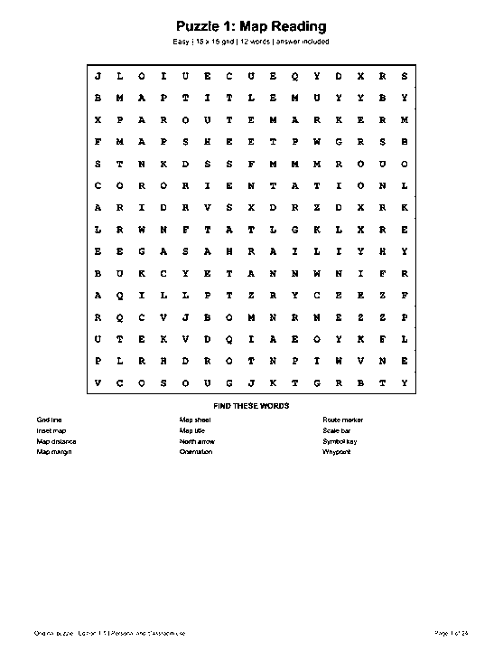
High-contrast preview: actual US Letter page 1, Puzzle 1: Map Reading. Open the PDF for full-size printing. The interactive viewer can display every original page.
Open this page in the full-size PDF
These levels describe grid mechanics, not a tested age range. Preview each target list and choose by reading familiarity and comfort with reverse or diagonal paths.
15x15 grids, 12 targets, and forward horizontal, vertical, and diagonal paths.
18x18 grids, 16 targets, reverse directions, and planned intersections.
20x20 grids, 20 targets, all eight directions, and denser overlaps.
Each theme has an independent list, a distinct grid, and its own highlighted answer page. Phrases appear without spaces in the grid.
15x15 - 12 targets - answer page 13
Map layout, orientation, reference, and distance-reading terms used on printed maps.15x15 - 12 targets - answer page 14
Coordinate-grid vocabulary for locating positions without naming disputed places or boundaries.15x15 - 12 targets - answer page 15
Stable terrain and relief terms rather than named mountains or ranking claims.15x15 - 12 targets - answer page 16
River-network vocabulary checked against U.S. Geological Survey water references.18x18 - 16 targets - answer page 17
Coastal forms and zones checked against NOAA and USGS educational glossaries.18x18 - 16 targets - answer page 18
Glacial erosion and deposition terms checked against NPS and USDA-NRCS references.18x18 - 16 targets - answer page 19
Dryland forms and processes checked against USGS desert references.18x18 - 16 targets - answer page 20
Plate-motion and related landform terms checked against USGS plate-tectonics references.20x20 - 20 targets - answer page 21
UN M49 statistical region labels; inclusion is for statistical convenience, not a sovereignty claim.20x20 - 20 targets - answer page 22
Cartographic and geospatial-data vocabulary used to describe digital map layers and representation.20x20 - 20 targets - answer page 23
U.S. Census Bureau statistical-geography terms; they are not universal definitions for every country.20x20 - 20 targets - answer page 24
Field mapping, observation, sampling, and spatial-recording vocabulary.These are the actual Map Reading, Glacial Landscapes, and Geospatial Data puzzles, not decorative mockups.
The pack covers stable map-reading, physical-geography, statistical-region, geospatial-data, settlement, and fieldwork vocabulary. It is not a border guide, gazetteer, or country-capital list.
The UN M49 labels are used only as statistical groupings, with the UN's political-status disclaimer. U.S. Census terms are labeled as U.S.-specific; the page avoids sovereignty claims and time-sensitive place facts.
Every target is reconstructed from its saved start, direction, and endpoint in the final grid.
The scanner checks all eight directions and requires each listed target to appear exactly once.
Every final grid is stored with its own matching answer. Familiar words can also appear in other independently built topic packs.
Terms were checked against current primary references. These links explain the vocabulary; the word search itself is not a substitute for a map or lesson.
USGS map symbol guide, USGS Water Science Glossary, and USDA-NRCS landform glossary.
UN M49 and the U.S. Census Geography Glossary.
Use Letter for 8.5x11-inch paper or A4 for 210x297-mm paper. Print at 100% or Actual Size. Print pages 1-12 for activities; answers begin on page 13.
Black-and-white printing works for the puzzles. The answer highlighting remains visible in grayscale.
You may print copies for personal use, one classroom, a homeschool group, a library activity, or a community event. Please do not resell or redistribute the PDF files.
Yes. Puzzles are on pages 1-12 and matching highlighted answers are on pages 13-24.
Start with Easy for forward-only paths, Medium for reverse paths and more intersections, or Challenging for longer words in 20x20 grids.
No country-capital matching list is used. The pack focuses on stable vocabulary and avoids disputed or time-sensitive place claims.
Spaces and punctuation are removed, so ZERO MERIDIAN appears as ZEROMERIDIAN.
Yes. Each PDF uses the true paper dimensions named on its download button.